Geolocate

Clear Lake topographic map

Click on the map to display elevation.

About this map

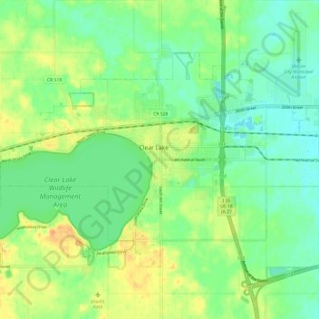
Name: Clear Lake topographic map, elevation, terrain.

Location: Clear Lake, Clear Lake Township, Cerro Gordo County, Iowa, 50428, United States (43.10469 -93.43827 43.16273 -93.32001)

Average elevation: 373 m

Minimum elevation: 357 m

Maximum elevation: 398 m

Other topographic maps

Click on a map to view its topography, its elevation and its terrain.

Emery

United States > Iowa > Cerro Gordo County

Average elevation: 361 m

Gear up for your next adventure:

🥾Waterproof Trail Shoes - Shoes designed to handle wet terrain
🧰Survival Kit - Essential gear for emergencies in the wilderness
🔋Emergency Crank Radio - Weather alerts and power without needing batteries
🧦Outdoor Socks - Durable socks designed for hiking and outdoor sports
🦶Anti-Blister Balm - Prevents friction and hotspots during long ascents

As an Amazon Associate, this site earns from qualifying purchases at no extra cost to you.