
Window Rock topographic map
Click on the map to display elevation.
Window Rock
Window Rock is categorized as being within the 6a USDA hardiness zone, meaning the average annual extreme minimum temperature is between −10 and −5 °F (−23 and −21 °C). The city is cooler than most of Arizona due to its high elevation.
About this map
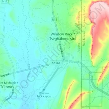
Name: Window Rock topographic map, elevation, terrain.
Average elevation: 2,084 m
Minimum elevation: 2,034 m
Maximum elevation: 2,247 m
Other topographic maps
Click on a map to view its topography, its elevation and its terrain.