Geolocate

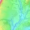
Chavillieu topographic map

Click on the map to display elevation.

About this map

Name: Chavillieu topographic map, elevation, terrain.

Location: Chavillieu, Lompnieu, Valromey-sur-Séran, Belley, Ain, Auvergne-Rhône-Alpes, France métropolitaine, 01260, France (45.94392 5.65311 45.98392 5.69311)

Average elevation: 691 m

Minimum elevation: 512 m

Maximum elevation: 1,062 m

Other topographic maps

Click on a map to view its topography, its elevation and its terrain.
Sutrieu

France > Auvergne-Rhône-Alpes > Ain > Valromey-sur-Séran

La superficie de la commune est de 1 905 hectares ; son altitude varie entre 459 et 1 200 mètres.

Average elevation: 697 m

Vieu

France > Auvergne-Rhône-Alpes > Ain > Valromey-sur-Séran

Average elevation: 428 m

Gear up for your next adventure:

🛶Kayak Accessories - Essential gear for safe and fun kayaking adventures
🚑Survival Whistle - Signal for help across long distances in mountains
👖Convertible Hiking Pants - Zip-off legs to adapt to changing weather conditions
👟Sport Hiking Sandals - Breathable footwear for water crossings and camp rest
☕Camping Coffee Maker - Brew fresh coffee anywhere on the topographic map

As an Amazon Associate, this site earns from qualifying purchases at no extra cost to you.