
Parque Montecristo topographic map
Click on the map to display elevation.
About this map
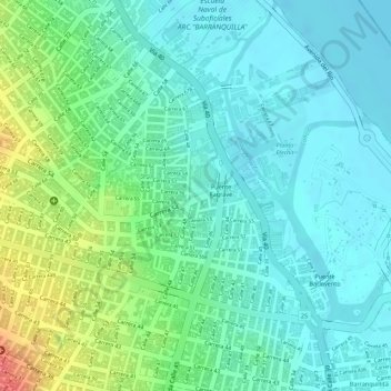
Name: Parque Montecristo topographic map, elevation, terrain.
Average elevation: 20 m
Minimum elevation: -2 m
Maximum elevation: 65 m
Other topographic maps
Click on a map to view its topography, its elevation and its terrain.
La Pradera
Colombia > Atlántico > Barranquilla > Perímetro Urbano Barranquilla
Average elevation: 35 m
Evaristo Sourdis
Colombia > Atlántico > Barranquilla > Perímetro Urbano Barranquilla
Average elevation: 44 m
Simón Bolívar
Colombia > Atlántico > Barranquilla > Perímetro Urbano Barranquilla
Average elevation: 21 m
JARDIN BOTANICO
Colombia > Atlántico > Barranquilla > Perímetro Urbano Barranquilla
Average elevation: 49 m
Localidad Riomar
Colombia > Atlántico > Barranquilla > Perímetro Urbano Barranquilla
Average elevation: 38 m
Loma Fresca
Colombia > Atlántico > Barranquilla > Perímetro Urbano Barranquilla
Average elevation: 47 m
Campo Alegre
Colombia > Atlántico > Barranquilla > Perímetro Urbano Barranquilla
Average elevation: 72 m
Las Estrellas
Colombia > Atlántico > Barranquilla > Perímetro Urbano Barranquilla
Average elevation: 53 m
Las Colinas
Colombia > Atlántico > Barranquilla > Perímetro Urbano Barranquilla
Average elevation: 88 m
Localidad Riomar
Colombia > Atlántico > Barranquilla > Perímetro Urbano Barranquilla
Average elevation: 38 m
Las Colinas
Colombia > Atlántico > Barranquilla > Perímetro Urbano Barranquilla
Average elevation: 88 m
Las Colinas
Colombia > Atlántico > Barranquilla > Perímetro Urbano Barranquilla
Average elevation: 88 m
Las Colinas
Colombia > Atlántico > Barranquilla > Perímetro Urbano Barranquilla
Average elevation: 88 m