Geolocate

Hondo topographic map

Click on the map to display elevation.

About this map

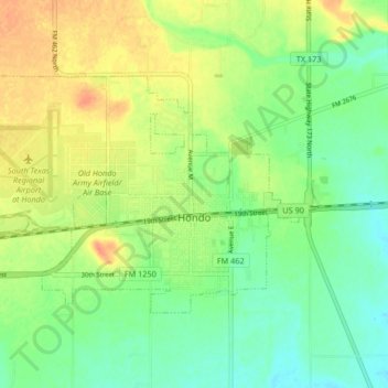
Name: Hondo topographic map, elevation, terrain.

Location: Hondo, Medina County, Texas, 78861, United States (29.32960 -99.20034 29.37393 -99.11754)

Average elevation: 272 m

Minimum elevation: 254 m

Maximum elevation: 293 m

Other topographic maps

Click on a map to view its topography, its elevation and its terrain.

Mico

United States > Texas > Medina County

Average elevation: 334 m

D'Hanis

United States > Texas > Medina County

D'Hanis is at an elevation of 883 feet (269 m) above sea level.

Average elevation: 273 m

Castroville

United States > Texas > Medina County

Average elevation: 249 m

Coal Mine

United States > Texas > Medina County > Lytle

Average elevation: 226 m

Noonan

United States > Texas > Medina County

Average elevation: 247 m

Gear up for your next adventure:

💧Hydration Bladder - Hands-free hydration solution for long treks
🎒Backpack Rain Cover - External shield to keep your entire pack dry
🔦LED Headtorch - Bright and durable light for night activities
🧭Orienteering Kit - Tools for map reading and navigation in the wild
🧦Merino Wool Socks - Moisture-wicking comfort for long-distance hiking

As an Amazon Associate, this site earns from qualifying purchases at no extra cost to you.