Geolocate

Bustos Dam topographic map

Click on the map to display elevation.

About this map
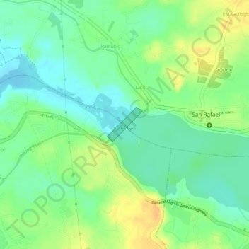
Name: Bustos Dam topographic map, elevation, terrain.

Location: Bustos Dam, Lico, San Rafael, Bulacan, Central Luzon, 3008, Philippines (14.95515 120.95260 14.95885 120.95651)

Average elevation: 24 m

Minimum elevation: 9 m

Maximum elevation: 41 m

Other topographic maps

Click on a map to view its topography, its elevation and its terrain.
Lico

Philippines > Bulacan > San Rafael > Lico

Average elevation: 26 m

Gear up for your next adventure:

💧Hydration Bladder - Hands-free hydration solution for long treks
🧰Emergency Multi-Tool - Compact multi-tool for outdoor survival
🛶Kayak Accessories - Essential gear for safe and fun kayaking adventures
🧢Hiking Hat - Sun-protective and breathable hats for long treks
⛺Family Camping Tent - Spacious tent suitable for family camping trips

As an Amazon Associate, this site earns from qualifying purchases at no extra cost to you.