Geolocate

Romsley topographic map

Click on the map to display elevation.

About this map

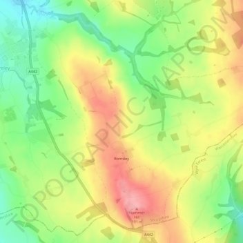
Name: Romsley topographic map, elevation, terrain.

Location: Romsley, Shropshire, West Midlands, England, United Kingdom (52.43621 -2.34231 52.46584 -2.28739)

Average elevation: 134 m

Minimum elevation: 79 m

Maximum elevation: 191 m

Gear up for your next adventure:

🥾Approach Boots - Comfortable boots for hiking and climbing approaches
🥾Mountain Hiking Shoes - Shoes with superior grip for mountainous terrain
🦯Trekking Poles - Reduced impact on joints for steep topographic climbs
🧼Travel Hand Sanitizer - Keep hands clean when water is scarce
🔦LED Flashlight - Powerful and long-lasting flashlight for camping and emergencies

As an Amazon Associate, this site earns from qualifying purchases at no extra cost to you.