Geolocate

Wallsend topographic map

Click on the map to display elevation.

About this map

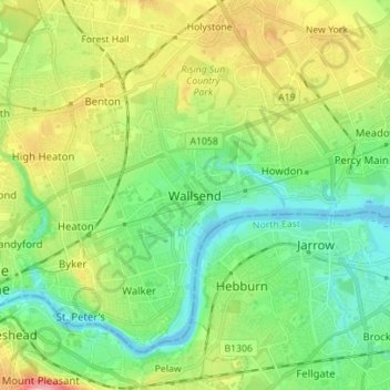
Name: Wallsend topographic map, elevation, terrain.

Location: Wallsend, North Tyneside, Tyne and Wear, North East, England, NE28 8QS, United Kingdom (54.95119 -1.57420 55.03119 -1.49420)

Average elevation: 41 m

Minimum elevation: -4 m

Maximum elevation: 122 m

Other topographic maps

Click on a map to view its topography, its elevation and its terrain.

Gear up for your next adventure:

🧊Portable Cooler - Keep food and drinks cold during outdoor adventures
💧Hydration Bladder - Hands-free hydration solution for long treks
🧢Sun Protection Cap - Breathable cap to protect from sun exposure
🥽Outdoor Goggles - Protective eyewear for outdoor activities
🦶Hiking Shoe Insoles - Added support for high arches and long days on feet

As an Amazon Associate, this site earns from qualifying purchases at no extra cost to you.