Geolocate

Rothenwand topographic map

Click on the map to display elevation.

About this map

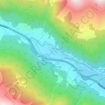
Name: Rothenwand topographic map, elevation, terrain.

Location: Rothenwand, Zederhaus, Bezirk Tamsweg, Salzburg, 5584, Austria (47.14543 13.45295 47.18543 13.49295)

Average elevation: 1,674 m

Minimum elevation: 1,200 m

Maximum elevation: 2,589 m

Other topographic maps

Click on a map to view its topography, its elevation and its terrain.

Tamsweg

Austria > Salzburg > Bezirk Tamsweg

Average elevation: 1,449 m

Prebersee

Austria > Salzburg > Bezirk Tamsweg > Tamsweg

Average elevation: 1,620 m

Muhr

Austria > Salzburg > Bezirk Tamsweg

Average elevation: 1,869 m

Mauterndorf

Austria > Salzburg > Bezirk Tamsweg

Average elevation: 1,377 m

Tamsweg

Austria > Salzburg > Bezirk Tamsweg

Average elevation: 1,449 m

Gear up for your next adventure:

🧥Ultralight Puffy Jacket - Maximum warmth that packs down to the size of an orange
🛌Insulated Sleeping Pad - Critical thermal barrier between you and the cold ground
🏕️Camping Hammock - Integrated protection for sleeping between trees
Bushcraft Tarp - Versatile emergency shelter or gear protection
🦟Insect Repellent - Keep mosquitoes and black flies away in wooded areas

As an Amazon Associate, this site earns from qualifying purchases at no extra cost to you.