
Gölköy topographic map
Interactive map
Click on the map to display elevation.
About this map
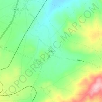
Name: Gölköy topographic map, elevation, terrain.
Location: Gölköy, Elâzığ Merkez, Elâzığ, Ostanatolien, Türkei (38.53318 39.05119 38.57318 39.09119)
Average elevation: 1,180 m
Minimum elevation: 1,114 m
Maximum elevation: 1,295 m
Other topographic maps
Click on a map to view its topography, its elevation and its terrain.
Tepeköy
Tepeköy, Elâzığ Merkez, Elâzığ, Ostanatolien, 23150, Türkei
Average elevation: 1,225 m