
Tepeköy topographic map
Interactive map
Click on the map to display elevation.
About this map
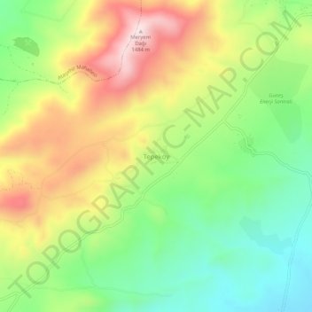
Name: Tepeköy topographic map, elevation, terrain.
Location: Tepeköy, Elâzığ Merkez, Elâzığ, Ostanatolien, 23150, Türkei (38.58653 39.13251 38.62653 39.17251)
Average elevation: 1,225 m
Minimum elevation: 1,023 m
Maximum elevation: 1,491 m
Other topographic maps
Click on a map to view its topography, its elevation and its terrain.
Gölköy
Gölköy, Elâzığ Merkez, Elâzığ, Ostanatolien, Türkei
Average elevation: 1,180 m