Geolocate

Montezuma topographic map

Click on the map to display elevation.

About this map

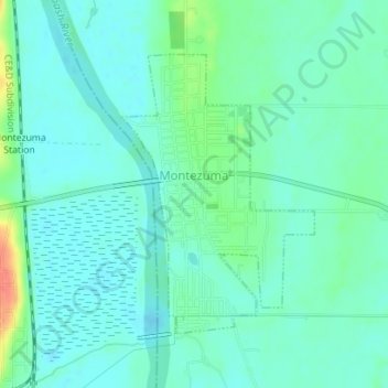
Name: Montezuma topographic map, elevation, terrain.

Location: Montezuma, Parke County, Indiana, 47862, United States (39.78180 -87.37740 39.80126 -87.35990)

Average elevation: 153 m

Minimum elevation: 141 m

Maximum elevation: 192 m

Other topographic maps

Click on a map to view its topography, its elevation and its terrain.

Bellmore

United States > Indiana > Parke County

Average elevation: 220 m

Leatherwood

United States > Indiana > Parke County

Average elevation: 202 m

Case Lake

United States > Indiana > Parke County

Average elevation: 186 m

Gear up for your next adventure:

🧭GPS Tracker - Track your location in remote areas safely
🧢Sun Hat - Wide-brim hat for sun protection
🧰Emergency Multi-Tool - Compact multi-tool for outdoor survival
🧭GPS Outdoor Watch - Smart watch for navigation and fitness tracking in nature
🥾Durable Hiking Shoes - Long-lasting shoes for frequent hiking

As an Amazon Associate, this site earns from qualifying purchases at no extra cost to you.