Geolocate

Beech topographic map

Click on the map to display elevation.

About this map
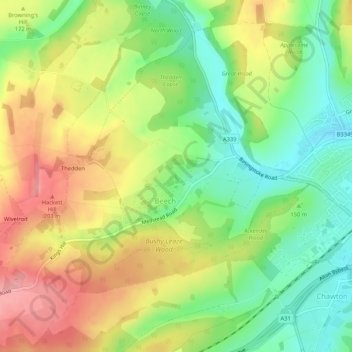
Name: Beech topographic map, elevation, terrain.

Location: Beech, East Hampshire, Hampshire, England, United Kingdom (51.12870 -1.04380 51.16172 -0.99162)

Average elevation: 157 m

Minimum elevation: 102 m

Maximum elevation: 220 m

Gear up for your next adventure:

🧤Rechargeable Heated Gloves - Extreme warmth for Canadian winter expeditions
🥾Trail Hiking Socks - Comfortable socks to prevent blisters and fatigue
🦌Outdoor Trail Camera - Monitor wildlife activity near your favorite spots
🥾Trail Running Boots - Durable shoes designed for trail running
👟Leg Gaiters - Keep debris, mud, and snow out of your boots

As an Amazon Associate, this site earns from qualifying purchases at no extra cost to you.