Geolocate

Pontinia topographic map

Click on the map to display elevation.

About this map

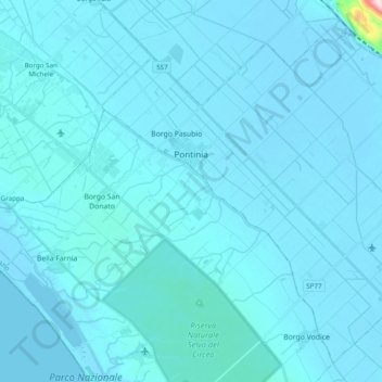
Name: Pontinia topographic map, elevation, terrain.

Location: Pontinia, Latina, Lazio, 04014, Italy (41.32869 12.99878 41.45996 13.19315)

Average elevation: 12 m

Minimum elevation: -3 m

Maximum elevation: 408 m

Other topographic maps

Click on a map to view its topography, its elevation and its terrain.

Borgo Sabotino

Italy > Lazio > Latina > Latina

Average elevation: 5 m

Palmarola

Italy > Lazio > Latina > Ponza

Average elevation: 13 m

Gear up for your next adventure:

🧦Thermal Socks - Warm socks for winter hiking or camping
🧴Waterproofing Spray - Restore the DWR coating on jackets and tents
🧣Merino Neck Gaiter - Protects against wind, sun, and cold at high altitudes
Family Camping Tent - Spacious tent suitable for family camping trips
🥾Trail Hiking Shoes - Durable shoes designed for rugged trails

As an Amazon Associate, this site earns from qualifying purchases at no extra cost to you.