Geolocate

Rothley topographic map

Click on the map to display elevation.

About this map
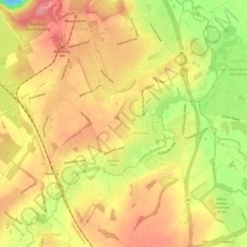
Name: Rothley topographic map, elevation, terrain.

Location: Rothley, Charnwood, Leicestershire, England, United Kingdom (52.69276 -1.17440 52.72932 -1.11832)

Average elevation: 64 m

Minimum elevation: -22 m

Maximum elevation: 102 m

Gear up for your next adventure:

🛌Down Sleeping Bag - Superior warmth-to-weight ratio for cold nights
🔭Outdoor Binoculars - Lightweight binoculars for birdwatching and hiking
🧥Waterproof Pants - Keep dry during rainy hiking conditions
🧰Multitool Knife - Compact and versatile tool for outdoor use
⛺Backpacking Tent - Lightweight tent for long-distance hiking trips

As an Amazon Associate, this site earns from qualifying purchases at no extra cost to you.