Geolocate

Pyecombe topographic map

Click on the map to display elevation.

About this map

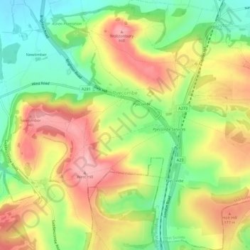
Name: Pyecombe topographic map, elevation, terrain.

Location: Pyecombe, Mid Sussex, West Sussex, England, United Kingdom (50.87973 -0.18406 50.91406 -0.13340)

Average elevation: 123 m

Minimum elevation: 40 m

Maximum elevation: 213 m

Gear up for your next adventure:

🛌Insulated Sleeping Pad - Critical thermal barrier between you and the cold ground
🧰Multitool Knife - Compact and versatile tool for outdoor use
🦶Hiking Shoe Insoles - Added support for high arches and long days on feet
🦟Insect Repellent - Keep mosquitoes and black flies away in wooded areas
🧥Waterproof Jacket - Lightweight rain jackets for hiking and outdoor activities

As an Amazon Associate, this site earns from qualifying purchases at no extra cost to you.