
Cynthia topographic map
Click on the map to display elevation.
About this map
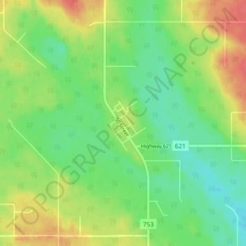
Name: Cynthia topographic map, elevation, terrain.
Location: Cynthia, Brazeau County, Alberta, T7A 1S3, Canada (53.26340 -115.44223 53.30340 -115.40223)
Average elevation: 919 m
Minimum elevation: 898 m
Maximum elevation: 948 m
Brazeau County trails, hiking, mountain biking, running and outdoor activities