Geolocate

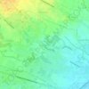
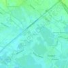
Maquiapo topographic map

Click on the map to display elevation.

About this map

Name: Maquiapo topographic map, elevation, terrain.

Location: Maquiapo, Pangulo District, Guagua, Pampanga, Central Luzon, 2003, Philippines (14.98319 120.54871 14.99961 120.57204)

Average elevation: 19 m

Minimum elevation: 13 m

Maximum elevation: 28 m

Other topographic maps

Click on a map to view its topography, its elevation and its terrain.

Lambac

Philippines > Pampanga > Guagua

Average elevation: 17 m

Natividad

Philippines > Pampanga > Guagua

Average elevation: 12 m

San Juan

Philippines > Pampanga > Guagua

Average elevation: 3 m

Jose Abad Santos

Philippines > Pampanga > Guagua

Average elevation: 6 m

San Pablo

Philippines > Pampanga > Guagua

Average elevation: 3 m

Purok Dayat

Philippines > Pampanga > Guagua > San Jose

Average elevation: 5 m

San Isidro

Philippines > Pampanga > Guagua

Average elevation: 3 m

Purok 2

Philippines > Pampanga > Guagua

Average elevation: 4 m

San Matias

Philippines > Pampanga > Guagua

Average elevation: 4 m

San Pablo

Philippines > Pampanga > Guagua

Average elevation: 3 m

Pulong Masle

Philippines > Pampanga > Guagua

Average elevation: 30 m

Gear up for your next adventure:

🧦Hiking Socks - Moisture-wicking and comfortable socks for long hikes
🕶️Polarized Sunglasses - Reduces glare from snow and water at high elevations
🥾All-Terrain Hiking Boots - Versatile boots for varied hiking conditions
⛺Tent Footprint - Protect tent floor and increase durability
🥫Freeze-Dried Meals - Lightweight, high-calorie nutrition for multi-day treks

As an Amazon Associate, this site earns from qualifying purchases at no extra cost to you.