
Bârsa topographic map
Interactive map
Click on the map to display elevation.
About this map
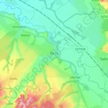
Name: Bârsa topographic map, elevation, terrain.
Location: Bârsa, Arad, Roumanie (46.33793 21.98535 46.41613 22.10783)
Average elevation: 147 m
Minimum elevation: 116 m
Maximum elevation: 228 m
Other topographic maps
Click on a map to view its topography, its elevation and its terrain.