
Bârsa topographic map
Interactive map
Click on the map to display elevation.
About this map
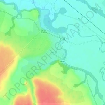
Name: Bârsa topographic map, elevation, terrain.
Location: Bârsa, Arad, 317025, Roumanie (46.35777 22.05250 46.39777 22.09250)
Average elevation: 141 m
Minimum elevation: 121 m
Maximum elevation: 177 m