Geolocate

Arundel topographic map

Click on the map to display elevation.

About this map

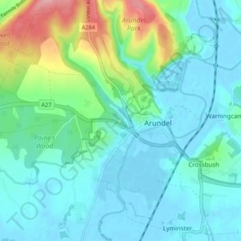
Name: Arundel topographic map, elevation, terrain.

Location: Arundel, Arun, West Sussex, England, United Kingdom (50.83173 -0.61157 50.87719 -0.53893)

Average elevation: 28 m

Minimum elevation: -4 m

Maximum elevation: 133 m

Gear up for your next adventure:

🛏️Camping Sleeping Mat - Comfortable mats for sleeping outdoors
🕯️Camping Lantern - Illuminates your entire campsite with high-efficiency LEDs
🥾Hiking Gaiters - Protect legs and shoes from mud, snow, and debris
👖Convertible Hiking Pants - Zip-off legs to adapt to changing weather conditions
Lightweight Camping Tent - Portable shelter optimized for Canadian backcountry camping

As an Amazon Associate, this site earns from qualifying purchases at no extra cost to you.