Geolocate

Hedvigsfors topographic map

Interactive map

Click on the map to display elevation.

About this map

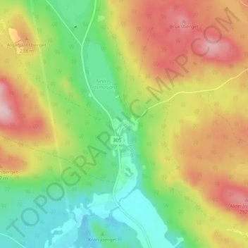
Name: Hedvigsfors topographic map, elevation, terrain.

Location: Hedvigsfors, Hudiksvalls kommun, Gävleborg County, Sweden (61.95628 16.44833 61.99628 16.48833)

Average elevation: 182 m

Minimum elevation: 86 m

Maximum elevation: 302 m

Other topographic maps

Click on a map to view its topography, its elevation and its terrain.

Gran

Sweden > Gävleborg County > Gnarp District

Average elevation: 0 m

Disan

Sweden > Gävleborg County

Average elevation: 43 m

Söderhamns kommun

Sweden > Gävleborg County

Average elevation: 67 m

Hudiksvalls kommun

Sweden > Gävleborg County

Average elevation: 95 m

Gnarp District

Sweden > Gävleborg County

Average elevation: 32 m

Gävle kommun

Sweden > Gävleborg County

Average elevation: 61 m

Ovanåkers kommun

Sweden > Gävleborg County

Average elevation: 269 m

Ljusdals kommun

Sweden > Gävleborg County

Average elevation: 317 m

Gävle

Sweden > Gävleborg County

Average elevation: 27 m

Hofors kommun

Sweden > Gävleborg County

Average elevation: 147 m