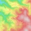
42660 topographic map
Click on the map to display elevation.
About this map

Name: 42660 topographic map, elevation, terrain.
Average elevation: 946 m
Minimum elevation: 489 m
Maximum elevation: 1,309 m
Other topographic maps
Click on a map to view its topography, its elevation and its terrain.
Col de la République
France > Auvergne-Rhône-Alpes > Loire > Saint-Genest-Malifaux
Le col de la République ou col du Grand Bois est situé sur la RD 1082 (ex-RN 82) et relie Saint-Étienne au nord de l'Ardèche. La route qui le franchit, dans les monts du Pilat, culmine à une altitude de 1 161 m. Il se situe sur la commune de Saint-Genest-Malifaux.
Average elevation: 1,142 m

La République
France > Auvergne-Rhône-Alpes > Loire > Saint-Genest-Malifaux
Average elevation: 1,028 m
Creux du Balay
France > Auvergne-Rhône-Alpes > Loire > Saint-Genest-Malifaux
Average elevation: 1,000 m