Geolocate

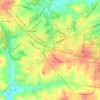
Burns topographic map

Click on the map to display elevation.

About this map

Name: Burns topographic map, elevation, terrain.

Location: Burns, Dickson County, Middle Tennessee, Tennessee, United States (36.03848 -87.35040 36.06527 -87.26259)

Average elevation: 239 m

Minimum elevation: 187 m

Maximum elevation: 280 m

Other topographic maps

Click on a map to view its topography, its elevation and its terrain.
East Dickson

United States > Tennessee > Dickson County > Dickson

Average elevation: 244 m

Edgewood

United States > Tennessee > Dickson County

Average elevation: 197 m

West Dickson

United States > Tennessee > Dickson County > Dickson

Average elevation: 250 m

Woods Valley

United States > Tennessee > Dickson County

Average elevation: 200 m

East Dickson

United States > Tennessee > Dickson County > Dickson

Average elevation: 244 m

West Dickson

United States > Tennessee > Dickson County > Dickson

Average elevation: 250 m

Oak Grove

United States > Tennessee > Dickson County

Average elevation: 234 m

Gear up for your next adventure:

🥾Lightweight Hiking Boots - Boots for comfort and mobility on long hikes
🧢Outdoor Visor - Breathable visor for sunny hikes
🚲Bike Repair Kit - Essential tools for on-trail mechanical issues
🦯Trekking Poles - Reduced impact on joints for steep topographic climbs
💧Reusable Water Bottle - Durable water bottles for hydration on trails

As an Amazon Associate, this site earns from qualifying purchases at no extra cost to you.