Geolocate

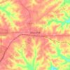
Edgewood topographic map

Click on the map to display elevation.

About this map

Name: Edgewood topographic map, elevation, terrain.

Location: Edgewood, Dickson County, Middle Tennessee, Tennessee, United States (36.16172 -87.55085 36.20172 -87.51085)

Average elevation: 197 m

Minimum elevation: 156 m

Maximum elevation: 245 m

Other topographic maps

Click on a map to view its topography, its elevation and its terrain.
Dickson

United States > Tennessee > Dickson County

Average elevation: 242 m

Vanleer

United States > Tennessee > Dickson County

Average elevation: 241 m

Charlotte

United States > Tennessee > Dickson County

Average elevation: 215 m

White Bluff

United States > Tennessee > Dickson County

Average elevation: 230 m

Burns

United States > Tennessee > Dickson County

Average elevation: 239 m

Dickson

United States > Tennessee > Dickson County

Average elevation: 242 m

White Bluff

United States > Tennessee > Dickson County

Average elevation: 230 m

Gear up for your next adventure:

🧭GPS Outdoor Watch - Smart watch for navigation and fitness tracking in nature
🧥Waterproof Pants - Keep dry during rainy hiking conditions
🥾Trekking Boots - Durable boots for long-distance trekking
📷Outdoor Action Camera - Capture high-elevation views and rugged adventures
🧢Outdoor Cap - Protective cap for sun and rain during hikes

As an Amazon Associate, this site earns from qualifying purchases at no extra cost to you.