Geolocate

Cheltenham topographic map

Click on the map to display elevation.

About this map

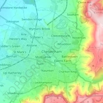
Name: Cheltenham topographic map, elevation, terrain.

Location: Cheltenham, Gloucestershire, England, GL52 2RX, United Kingdom (51.85957 -2.11116 51.93957 -2.03116)

Average elevation: 106 m

Minimum elevation: 22 m

Maximum elevation: 329 m

Gear up for your next adventure:

🥽Outdoor Goggles - Protective eyewear for outdoor activities
🧦Outdoor Socks - Durable socks designed for hiking and outdoor sports
🧭GPS Outdoor Watch - Smart watch for navigation and fitness tracking in nature
🎒Hiking Backpack - Lightweight and ergonomic backpacks for day hikes or multi-day treks
🍽️Titanium Camping Spork - Ultralight and indestructible eating utensil

As an Amazon Associate, this site earns from qualifying purchases at no extra cost to you.