Geolocate

Montecito topographic map

Click on the map to display elevation.

About this map
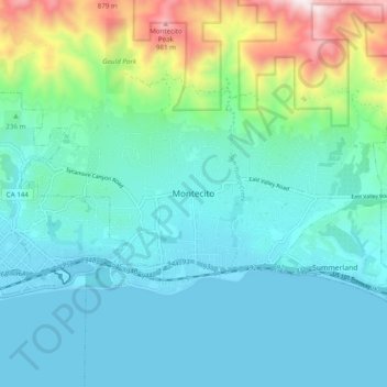
Name: Montecito topographic map, elevation, terrain.

Location: Montecito, Santa Barbara County, California, 93108, United States (34.39666 -119.67208 34.47666 -119.59208)

Average elevation: 213 m

Minimum elevation: -1 m

Maximum elevation: 1,077 m

Other topographic maps

Click on a map to view its topography, its elevation and its terrain.

Gear up for your next adventure:

🧥Insulated Jacket - Keep warm in cold outdoor conditions
🔦LED Headtorch - Bright and durable light for night activities
🧥Packable Rain Jacket - Breathable waterproof layer for unpredictable weather
⛺Camping Essentials - All-in-one gear for a comfortable camping trip
🧴Bear Spray Holster - Quick-access carry for essential Canadian wilderness safety

As an Amazon Associate, this site earns from qualifying purchases at no extra cost to you.