Geolocate

Mapleton topographic map

Click on the map to display elevation.

About this map

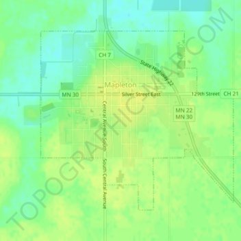
Name: Mapleton topographic map, elevation, terrain.

Location: Mapleton, Blue Earth County, Minnesota, 56065, United States (43.91478 -93.96850 43.93487 -93.93848)

Average elevation: 313 m

Minimum elevation: 302 m

Maximum elevation: 321 m

Other topographic maps

Click on a map to view its topography, its elevation and its terrain.

Benning

United States > Minnesota > Blue Earth County > Mankato

Average elevation: 257 m

Beauford

United States > Minnesota > Blue Earth County

Average elevation: 306 m

Gear up for your next adventure:

🦌Outdoor Trail Camera - Monitor wildlife activity near your favorite spots
🧰Multitool Knife - Compact and versatile tool for outdoor use
💡Solar Camping Lamp - Eco-friendly lighting for campsites
🧦Outdoor Socks - Durable socks designed for hiking and outdoor sports
🍽️Titanium Camping Spork - Ultralight and indestructible eating utensil

As an Amazon Associate, this site earns from qualifying purchases at no extra cost to you.