Geolocate

Manhattan topographic map

Click on the map to display elevation.

About this map

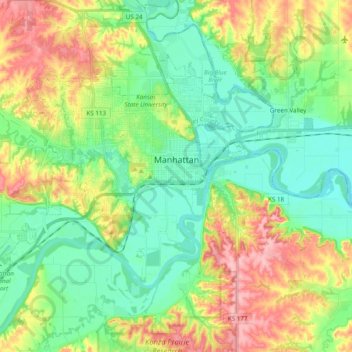
Name: Manhattan topographic map, elevation, terrain.

Location: Manhattan, Riley County, Kansas, United States (39.12413 -96.69028 39.22880 -96.49671)

Average elevation: 344 m

Minimum elevation: 297 m

Maximum elevation: 428 m

Other topographic maps

Click on a map to view its topography, its elevation and its terrain.

Rocky Ford

United States > Kansas > Riley County

Average elevation: 331 m

Gear up for your next adventure:

🎒Fully Waterproof Backpack - Total protection for photography gear and electronics
🔋Lithium AA Batteries - Long-lasting power that performs in extreme cold
🦌Outdoor Trail Camera - Monitor wildlife activity near your favorite spots
💡Portable Camping Lamp - Rechargeable lamp for campsite lighting
Lightweight Backpacking Tent - Compact tent for efficient hiking trips

As an Amazon Associate, this site earns from qualifying purchases at no extra cost to you.