Geolocate

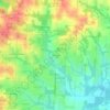
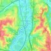
Independence topographic map

Click on the map to display elevation.

About this map
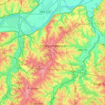
Name: Independence topographic map, elevation, terrain.

Location: Independence, Jackson County, Missouri, United States (39.01768 -94.48150 39.13987 -94.21601)

Average elevation: 261 m

Minimum elevation: 215 m

Maximum elevation: 330 m

Other topographic maps

Click on a map to view its topography, its elevation and its terrain.
Eastwood

United States > Missouri > Jackson County > Kansas City

Average elevation: 259 m

Pink Hill

United States > Missouri > Jackson County

Average elevation: 260 m

Leeds

United States > Missouri > Jackson County > Kansas City

Average elevation: 252 m

Ruskin

United States > Missouri > Jackson County > Kansas City

Average elevation: 302 m

Bryant

United States > Missouri > Jackson County > Kansas City

Average elevation: 292 m

Eastwood

United States > Missouri > Jackson County > Kansas City

Average elevation: 259 m

Cobbler

United States > Missouri > Jackson County

Average elevation: 237 m

Gear up for your next adventure:

🧥Waterproof Jacket - Lightweight rain jackets for hiking and outdoor activities
🥾Mountain Hiking Shoes - Shoes with superior grip for mountainous terrain
👟Sport Hiking Sandals - Breathable footwear for water crossings and camp rest
🧰Multitool Knife - Compact and versatile tool for outdoor use
🔦LED Flashlight - Powerful and long-lasting flashlight for camping and emergencies

As an Amazon Associate, this site earns from qualifying purchases at no extra cost to you.