Geolocate

Centropolis topographic map

Click on the map to display elevation.

About this map

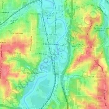
Name: Centropolis topographic map, elevation, terrain.

Location: Centropolis, Kansas City, Jackson County, Missouri, 64126, United States (39.06973 -94.51440 39.10973 -94.47440)

Average elevation: 253 m

Minimum elevation: 221 m

Maximum elevation: 294 m

Other topographic maps

Click on a map to view its topography, its elevation and its terrain.

Gear up for your next adventure:

👟Trail Running Shoes - Agile footwear for fast-paced topographic exploration
🧥Insulated Jacket - Keep warm in cold outdoor conditions
🧦Outdoor Socks - Durable socks designed for hiking and outdoor sports
🧥Packable Rain Jacket - Breathable waterproof layer for unpredictable weather
🌡️Emergency Mylar Blankets - Compact thermal protection for unexpected nights outdoors

As an Amazon Associate, this site earns from qualifying purchases at no extra cost to you.