Geolocate

Pierson topographic map

Click on the map to display elevation.

About this map
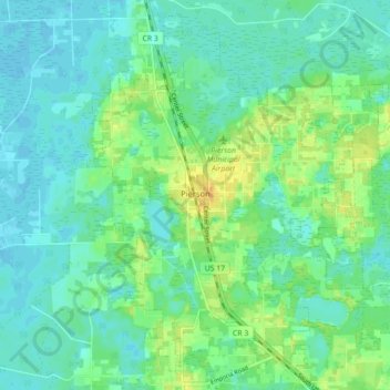
Name: Pierson topographic map, elevation, terrain.

Location: Pierson, Volusia County, Florida, 32180, United States (29.20373 -81.48978 29.27440 -81.40170)

Average elevation: 14 m

Minimum elevation: 5 m

Maximum elevation: 32 m

Other topographic maps

Click on a map to view its topography, its elevation and its terrain.

Jones Island

United States > Florida > Volusia County

Average elevation: 13 m

Gear up for your next adventure:

🔪Outdoor Multitool - Versatile tool for repairs and food prep in the wild
🛁Quick-Dry Microfiber Towel - Space-saving towel that dries rapidly on the move
🥾Waterproof Hiking Shoes - Durable shoes for wet and rugged trails
🧤Rechargeable Heated Gloves - Extreme warmth for Canadian winter expeditions
🎒Hiking Daypack - Lightweight and durable backpacks for day trips and excursions

As an Amazon Associate, this site earns from qualifying purchases at no extra cost to you.