Geolocate

Caret topographic map

Click on the map to display elevation.

About this map

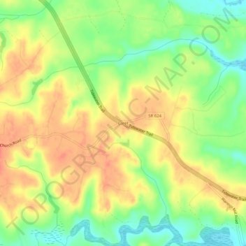
Name: Caret topographic map, elevation, terrain.

Location: Caret, Essex County, Virginia, United States (37.96264 -76.98136 38.00264 -76.94136)

Average elevation: 30 m

Minimum elevation: 0 m

Maximum elevation: 55 m

Other topographic maps

Click on a map to view its topography, its elevation and its terrain.

Tappahannock

United States > Virginia > Essex County

Average elevation: 6 m

Gear up for your next adventure:

🛌Down Sleeping Bag - Superior warmth-to-weight ratio for cold nights
🧊Portable Cooler - Keep food and drinks cold during outdoor adventures
🚲Heavy Duty Bike Lock - Secure your bike at the trailhead or during stops
🥤Collapsible Travel Cup - Saves space and weight in your mess kit
🥾All-Terrain Hiking Boots - Versatile boots for varied hiking conditions

As an Amazon Associate, this site earns from qualifying purchases at no extra cost to you.