Geolocate

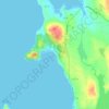
Fleuve Churchill topographic map

Click on the map to display elevation.

About this map

Name: Fleuve Churchill topographic map, elevation, terrain.

Location: Fleuve Churchill, Terre-Neuve et Labrador, Canada (52.85953 -65.03182 53.86944 -60.17480)

Average elevation: 450 m

Minimum elevation: -2 m

Maximum elevation: 850 m

Other topographic maps

Click on a map to view its topography, its elevation and its terrain.
Mont D'Iberville

Canada > Terre-Neuve et Labrador

Average elevation: 1,272 m

Lethbridge

Canada > Terre-Neuve et Labrador

Average elevation: 24 m

Kaipokok

Canada > Terre-Neuve et Labrador

Average elevation: 69 m

Sheshatshiu

Canada > Terre-Neuve et Labrador

Average elevation: 12 m

Natuashish

Canada > Terre-Neuve et Labrador

Average elevation: 24 m

Gros Morne

Canada > Terre-Neuve et Labrador

Average elevation: 561 m

Jackson Arm

Canada > Terre-Neuve et Labrador

Average elevation: 170 m

Postville

Canada > Terre-Neuve et Labrador > Postville

Average elevation: 26 m

Rigolet

Canada > Terre-Neuve et Labrador > Rigolet

Average elevation: 13 m

Mont D'Iberville

Canada > Terre-Neuve et Labrador

Average elevation: 1,272 m

St. Lunaire

Canada > Terre-Neuve et Labrador

Average elevation: 16 m

Dildo

Canada > Terre-Neuve et Labrador

Average elevation: 12 m

Gear up for your next adventure:

🧥Softshell Jacket - Windproof and breathable jacket for hiking
🥾Lightweight Hiking Boots - Boots for comfort and mobility on long hikes
🐕Hiking Dog Pack - Let your canine companion carry their own water and food
🪑Ultralight Camping Stool - Compact seating for rest stops during long hikes
🩹Moleskin Blister Pads - Direct protection for painful foot pressure points

As an Amazon Associate, this site earns from qualifying purchases at no extra cost to you.