Geolocate

Rigolet topographic map

Click on the map to display elevation.

About this map

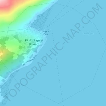
Name: Rigolet topographic map, elevation, terrain.

Location: Rigolet, Labrador, Terre-Neuve et Labrador, Canada (54.16219 -58.44581 54.18804 -58.39958)

Average elevation: 13 m

Minimum elevation: 0 m

Maximum elevation: 181 m

Gear up for your next adventure:

💡Compact LED Flashlight - Powerful and portable flashlight for outdoor use
🎒Fully Waterproof Backpack - Total protection for photography gear and electronics
❄️Traction Ice Cleats - Slip-on spikes for icy trails and winter hiking
🧥Thermal Fleece Jacket - Versatile insulation for changing mountain temperatures
🐕Hiking Dog Pack - Let your canine companion carry their own water and food

As an Amazon Associate, this site earns from qualifying purchases at no extra cost to you.