Geolocate

Sylvan Lake topographic map

Click on the map to display elevation.

About this map

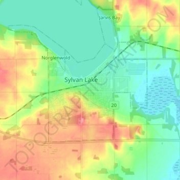
Name: Sylvan Lake topographic map, elevation, terrain.

Location: Sylvan Lake, Town of Sylvan Lake, Alberta, T4S 1S3, Canada (52.27021 -114.13742 52.35021 -114.05742)

Average elevation: 958 m

Minimum elevation: 930 m

Maximum elevation: 1,002 m

Town of Sylvan Lake trails, hiking, mountain biking, running and outdoor activities

Gear up for your next adventure:

🔋Lithium AA Batteries - Long-lasting power that performs in extreme cold
🦟Insect Repellent - Keep mosquitoes and black flies away in wooded areas
Backpacking Tent - Lightweight tent for long-distance hiking trips
🧼Biodegradable Camp Soap - Environmentally friendly cleaning for gear and body
🌡️Emergency Mylar Blankets - Compact thermal protection for unexpected nights outdoors

As an Amazon Associate, this site earns from qualifying purchases at no extra cost to you.