
Shook topographic map
Click on the map to display elevation.
About this map
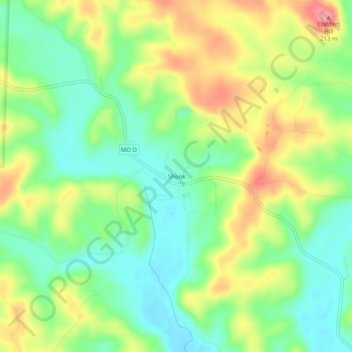
Name: Shook topographic map, elevation, terrain.
Location: Shook, Wayne County, Missouri, United States (37.02283 -90.32900 37.06283 -90.28900)
Average elevation: 151 m
Minimum elevation: 110 m
Maximum elevation: 209 m
Other topographic maps
Click on a map to view its topography, its elevation and its terrain.