

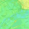
Staines-upon-Thames topographic map
Click on the map to display elevation.
Staines-upon-Thames
Much of the town is built on gravel "islands" that rise above the low-lying floodplains of the Thames and Colne. These gravel deposits have a typical maximum elevation of 14 m (46 ft) above ordnance datum (AOD) and are as little as 0.5 m (1.6 ft) above the surrounding floodplain. Staines High Street, oriented northeast to southwest, runs across one of these islands to the site of the medieval bridge and was the nucleus of the Roman town. St Mary's Church, on "Binbury island" to the northwest of the centre, is thought to have been the focus of settlement activity in the late-Saxon period. Elevations below 13.5 m (44 ft) AOD were liable to flooding until the early 19th century and many areas of gravel are covered by muddy silts and sands. There are brickearth deposits to the east of the town, along the A30, and outcrops of alluvium to the north and south.
About this map

Name: Staines-upon-Thames topographic map, elevation, terrain.
Average elevation: 20 m
Minimum elevation: 3 m
Maximum elevation: 89 m
Other topographic maps
Click on a map to view its topography, its elevation and its terrain.



Queen Mary Reservoir
United Kingdom > England > Surrey > Borough of Spelthorne > Charlton
Average elevation: 14 m
Sunbury Court Island
United Kingdom > England > Surrey > Borough of Spelthorne
Average elevation: 13 m

Shepperton
United Kingdom > England > Surrey > Borough of Spelthorne
Shepperton has a long boundary with the River Thames in its southernmost salient, which almost surrounds Spelthorne. Old Shepperton is almost surrounded by the extreme southern meander within this. Prehistoric glacial retreat north of this has made the north bank almost flat for a considerable distance and as…
Average elevation: 12 m