Geolocate

Waverly topographic map

Click on the map to display elevation.

About this map

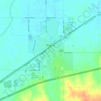
Name: Waverly topographic map, elevation, terrain.

Location: Waverly, Lancaster County, Nebraska, 68462, United States (40.89422 -96.56436 40.93612 -96.51596)

Average elevation: 346 m

Minimum elevation: 336 m

Maximum elevation: 377 m

Other topographic maps

Click on a map to view its topography, its elevation and its terrain.

Princeton

United States > Nebraska > Lancaster County

Average elevation: 432 m

Gear up for your next adventure:

🌡️Emergency Mylar Blankets - Compact thermal protection for unexpected nights outdoors
💡LED Camping Lantern - Illuminate your campsite with long-lasting lanterns
🧢Outdoor Visor - Breathable visor for sunny hikes
🔋Lithium AA Batteries - Long-lasting power that performs in extreme cold
Lightweight Camping Tent - Portable shelter optimized for Canadian backcountry camping

As an Amazon Associate, this site earns from qualifying purchases at no extra cost to you.