Geolocate

Bedford topographic map

Click on the map to display elevation.

About this map
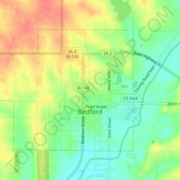
Name: Bedford topographic map, elevation, terrain.

Location: Bedford, Taylor County, Iowa, 50833, United States (40.66211 -94.73986 40.68040 -94.71138)

Average elevation: 354 m

Minimum elevation: 329 m

Maximum elevation: 381 m

Gear up for your next adventure:

🧢Sun Hat - Wide-brim hat for sun protection
🥾Light Trekking Boots - Supportive boots for multi-day treks
🥾Waterproof Hiking Boots - Boots keeping your feet dry in wet conditions
🔪Outdoor Multitool - Versatile tool for repairs and food prep in the wild
🧴Sunscreen SPF - Broad-spectrum sunscreen for outdoor activities

As an Amazon Associate, this site earns from qualifying purchases at no extra cost to you.