Geolocate

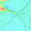
Lacquios topographic map

Click on the map to display elevation.

About this map

Name: Lacquios topographic map, elevation, terrain.

Location: Lacquios, Arayat, Pampanga, Central Luzon, 2012, Philippines (15.16152 120.76893 15.17256 120.78236)

Average elevation: 14 m

Minimum elevation: -1 m

Maximum elevation: 132 m

Other topographic maps

Click on a map to view its topography, its elevation and its terrain.
Telapayong

Philippines > Pampanga > Arayat

Average elevation: 42 m

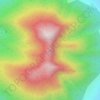
Mount Arayat

Philippines > Pampanga > Arayat

Mount Arayat stands in the middle of the flat Central Luzon Plain, consisting of rice paddies and a typical elevation of about 15 to 35 metres MSL. The mountain is topped by a circular volcanic crater about 1.2 kilometres (0.75 mi) in diameter, much of which has collapsed on the western and part of the…

Average elevation: 639 m

San Antonio

Philippines > Pampanga > Arayat

Average elevation: 28 m

San Jose Mesulo

Philippines > Pampanga > Arayat

Average elevation: 9 m

San Roque Bitas

Philippines > Pampanga > Arayat

Average elevation: 29 m

San Juan Baño

Philippines > Pampanga > Arayat

Average elevation: 58 m

Mangga-Cacutud

Philippines > Pampanga > Arayat

Average elevation: 11 m

San Agustin Norte

Philippines > Pampanga > Arayat

Average elevation: 13 m

Arenas

Philippines > Pampanga > Arayat

Average elevation: 33 m

San Nicolas

Philippines > Pampanga > Arayat

Average elevation: 8 m

Gatiawin

Philippines > Pampanga > Arayat

Average elevation: 22 m

Buensuceso

Philippines > Pampanga > Arayat

Average elevation: 39 m

Baliti

Philippines > Pampanga > Arayat

Average elevation: 45 m

Mount Arayat

Philippines > Pampanga > Arayat

Mount Arayat stands in the middle of the flat Central Luzon Plain, consisting of rice paddies and a typical elevation of about 15 to 35 metres MSL. The mountain is topped by a circular volcanic crater about 1.2 kilometres (0.75 mi) in diameter, much of which has collapsed on the western and part of the…

Average elevation: 639 m

Mount Arayat

Philippines > Pampanga > Arayat

Mount Arayat stands in the middle of the flat Central Luzon Plain, consisting of rice paddies and a typical elevation of about 15 to 35 metres (49 to 115 ft) AMSL. The mountain is topped by a circular volcanic crater about 1.2 kilometres (0.75 mi) in diameter, much of which has collapsed on the western and…

Average elevation: 639 m

Baliti

Philippines > Pampanga > Arayat

Average elevation: 45 m

Gatiawin

Philippines > Pampanga > Arayat

Average elevation: 22 m

San Agustin Norte

Philippines > Pampanga > Arayat

Average elevation: 13 m

San Juan Baño

Philippines > Pampanga > Arayat

Average elevation: 58 m

San Antonio

Philippines > Pampanga > Arayat

Average elevation: 28 m

Baliti

Philippines > Pampanga > Arayat

Average elevation: 45 m

Guemasan

Philippines > Pampanga > Arayat

Average elevation: 9 m

Batasan

Philippines > Pampanga > Arayat

Average elevation: 9 m

Gear up for your next adventure:

🥾Lightweight Hiking Shoes - Comfortable shoes for day hikes
💧Filtered Water Bottle - Safe drinking water on the go
🩹Moleskin Blister Pads - Direct protection for painful foot pressure points
🧥Waterproof Jacket - Lightweight rain jackets for hiking and outdoor activities
🛶Kayak Accessories - Essential gear for safe and fun kayaking adventures

As an Amazon Associate, this site earns from qualifying purchases at no extra cost to you.