Geolocate

Batasan topographic map

Click on the map to display elevation.

About this map

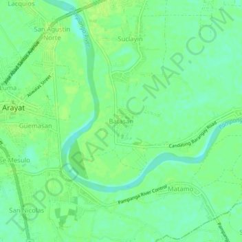
Name: Batasan topographic map, elevation, terrain.

Location: Batasan, Arayat, Pampanga, Central Luzon, 2012, Philippines (15.12820 120.77114 15.16820 120.81114)

Average elevation: 9 m

Minimum elevation: 1 m

Maximum elevation: 14 m

Other topographic maps

Click on a map to view its topography, its elevation and its terrain.

Gear up for your next adventure:

🧦Hiking Socks - Moisture-wicking and comfortable socks for long hikes
🔦LED Flashlight - Powerful and long-lasting flashlight for camping and emergencies
🥾Trail Hiking Boots - Supportive boots for rough trails
🧭Orienteering Kit - Tools for map reading and navigation in the wild
🧢Outdoor Cap - Protective cap for sun and rain during hikes

As an Amazon Associate, this site earns from qualifying purchases at no extra cost to you.