Geolocate

Dutton Locks topographic map

Click on the map to display elevation.

About this map

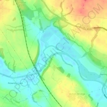
Name: Dutton Locks topographic map, elevation, terrain.

Location: Dutton Locks, Dutton, Acton Bridge, Cheshire West and Chester, England, CW8 3QQ, United Kingdom (53.27786 -2.63193 53.29786 -2.61193)

Average elevation: 28 m

Minimum elevation: 5 m

Maximum elevation: 59 m

Other topographic maps

Click on a map to view its topography, its elevation and its terrain.

Gear up for your next adventure:

🥾Approach Boots - Comfortable boots for hiking and climbing approaches
🛶Kayak Dry Bag - Waterproof storage for kayaking adventures
🧼Travel Hand Sanitizer - Keep hands clean when water is scarce
🛶Waterproof Dry Bags - Keep electronics and clothes dry during river crossings
Tent Footprint - Protect tent floor and increase durability

As an Amazon Associate, this site earns from qualifying purchases at no extra cost to you.