Geolocate

Tuthult topographic map

Click on the map to display elevation.

About this map

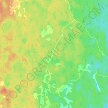
Name: Tuthult topographic map, elevation, terrain.

Location: Tuthult, Torsås kommun, Kalmar County, Sweden (56.44006 15.85031 56.48006 15.89031)

Average elevation: 66 m

Minimum elevation: 46 m

Maximum elevation: 84 m

Other topographic maps

Click on a map to view its topography, its elevation and its terrain.

Emmaboda kommun

Sweden > Kalmar County

Average elevation: 141 m

Hansa City

Sweden > Kalmar County

Average elevation: 7 m

Högsby kommun

Sweden > Kalmar County

Average elevation: 97 m

Nybro kommun

Sweden > Kalmar County

Average elevation: 109 m

Hultsfreds kommun

Sweden > Kalmar County

Average elevation: 143 m

Store Hindsjön

Sweden > Kalmar County

Average elevation: 118 m

Mönsterås kommun

Sweden > Kalmar County

Average elevation: 26 m

Alen

Sweden > Kalmar County

Average elevation: 142 m

Emmaboda kommun

Sweden > Kalmar County

Average elevation: 141 m

Oskarshamns kommun

Sweden > Kalmar County

Average elevation: 63 m

Kalmar kommun

Sweden > Kalmar County

Average elevation: 28 m

Gear up for your next adventure:

🧦Thermal Socks - Warm socks for winter hiking or camping
🧭GPS Tracker - Track your location in remote areas safely
🚲Bike Repair Kit - Essential tools for on-trail mechanical issues
🥾Hiking Boots - Sturdy boots providing ankle support and traction on rugged trails
🧥Fleece Jacket - Warm and lightweight jacket for layering

As an Amazon Associate, this site earns from qualifying purchases at no extra cost to you.