Geolocate

Agravaram topographic map

Click on the map to display elevation.

About this map
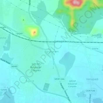
Name: Agravaram topographic map, elevation, terrain.

Location: Agravaram, Wallajah, Ranipet, Tamil Nadu, 632403, India (12.94774 79.29181 12.98774 79.33181)

Average elevation: 196 m

Minimum elevation: 170 m

Maximum elevation: 367 m

Other topographic maps

Click on a map to view its topography, its elevation and its terrain.

Wallajah

India > Tamil Nadu > Wallajah

Average elevation: 179 m

Gear up for your next adventure:

🔭Compact Binoculars - Lightweight optics for scouting trails and wildlife
🧴Outdoor Sunscreen - High SPF protection for high-altitude UV exposure
🥾Trail Running Shoes - Lightweight and durable shoes for trail running
🏕️Camping Hammock - Integrated protection for sleeping between trees
🥾Trekking Poles - Adjustable trekking poles to reduce knee stress and improve stability

As an Amazon Associate, this site earns from qualifying purchases at no extra cost to you.