Geolocate

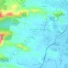
Landrigans topographic map

Click on the map to display elevation.

About this map

Name: Landrigans topographic map, elevation, terrain.

Location: Landrigans, Karangi, Coffs Harbour, New South Wales, 2450, Australia (-30.30167 153.03111 -30.26167 153.07111)

Average elevation: 157 m

Minimum elevation: 22 m

Maximum elevation: 331 m

Other topographic maps

Click on a map to view its topography, its elevation and its terrain.

Boambee

Australia > New South Wales > Coffs Harbour

Average elevation: 18 m

Gear up for your next adventure:

🧳Compression Sacks - Maximize space in your backpack by shrinking gear
🥾Hiking Gaiters - Protect legs and shoes from mud, snow, and debris
👟Sport Hiking Sandals - Breathable footwear for water crossings and camp rest
🥤Collapsible Travel Cup - Saves space and weight in your mess kit
🧼Biodegradable Camp Soap - Environmentally friendly cleaning for gear and body

As an Amazon Associate, this site earns from qualifying purchases at no extra cost to you.