Geolocate

Lamela topographic map

Click on the map to display elevation.

About this map

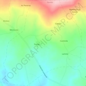
Name: Lamela topographic map, elevation, terrain.

Location: Lamela, Guntín, Lugo, Galicia, España (42.92271 -7.71374 42.95208 -7.67712)

Average elevation: 597 m

Minimum elevation: 516 m

Maximum elevation: 743 m

Other topographic maps

Click on a map to view its topography, its elevation and its terrain.

Montouto

España > Galicia > Lugo > Guntín > Montouto

Average elevation: 604 m

Leboriz

España > Galicia > Lugo > Guntín

Average elevation: 392 m

Vilarreal

España > Galicia > Lugo > Guntín > Vilarreal

Average elevation: 604 m

O Xuriz

España > Galicia > Lugo > Guntín

Average elevation: 601 m

Gear up for your next adventure:

🔥Camping Stove - Portable stoves to cook outdoors with ease
🧥Waterproof Jacket - Lightweight rain jackets for hiking and outdoor activities
🧼Travel Hand Sanitizer - Keep hands clean when water is scarce
👖Convertible Hiking Pants - Zip-off legs to adapt to changing weather conditions
🥾Hiking Gaiters - Protect legs and shoes from mud, snow, and debris

As an Amazon Associate, this site earns from qualifying purchases at no extra cost to you.