Geolocate

Clive topographic map

Click on the map to display elevation.

About this map
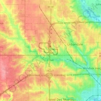
Name: Clive topographic map, elevation, terrain.

Location: Clive, Polk County, Iowa, 50325, United States (41.59642 -93.87222 41.64379 -93.71810)

Average elevation: 287 m

Minimum elevation: 242 m

Maximum elevation: 326 m

Other topographic maps

Click on a map to view its topography, its elevation and its terrain.

Saylorville

United States > Iowa > Polk County

Average elevation: 266 m

Gear up for your next adventure:

🔨Vehicle Emergency Tool - Safety tool for remote road trips to trailheads
🧤Insulated Winter Gloves - Heavy-duty protection for sub-zero Canadian adventures
🧥Ultralight Puffy Jacket - Maximum warmth that packs down to the size of an orange
🔭Compact Binoculars - Lightweight optics for scouting trails and wildlife
👖Convertible Hiking Pants - Zip-off legs to adapt to changing weather conditions

As an Amazon Associate, this site earns from qualifying purchases at no extra cost to you.