Geolocate

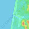
Lit-et-Mixe topographic map

Click on the map to display elevation.

About this map

Name: Lit-et-Mixe topographic map, elevation, terrain.

Location: Lit-et-Mixe, District of Dax, Landes, Nouvelle-Aquitaine, Metropolitan France, 40170, France (43.96448 -1.35189 44.08997 -1.18937)

Average elevation: 27 m

Minimum elevation: -1 m

Maximum elevation: 74 m

Other topographic maps

Click on a map to view its topography, its elevation and its terrain.

Lassale

France > Nouvelle-Aquitaine > Landes > Castandet

Average elevation: 95 m

Jay

France > Nouvelle-Aquitaine > Landes > Sarbazan

Average elevation: 93 m

Sanguina

France > Nouvelle-Aquitaine > Landes > Luglon

Average elevation: 89 m

ME ?

France > Nouvelle-Aquitaine > Landes > Saint-Pierre-du-Mont

Average elevation: 90 m

Chit

France > Nouvelle-Aquitaine > Landes > Payros-Cazautets

Average elevation: 129 m

Bélida

France > Nouvelle-Aquitaine > Landes > Meilhan

Average elevation: 74 m

Milord

France > Nouvelle-Aquitaine > Landes > Mugron

Average elevation: 65 m

Le Conte

France > Nouvelle-Aquitaine > Landes > Geaune > Pichots

Average elevation: 134 m

Huron

France > Nouvelle-Aquitaine > Landes > Geaune

Average elevation: 157 m

Pabon

France > Nouvelle-Aquitaine > Landes > Garein

Average elevation: 95 m

Molin Nau

France > Nouvelle-Aquitaine > Landes > Mimizan

Average elevation: 20 m

Gear up for your next adventure:

🧦Thermal Socks - Warm socks for winter hiking or camping
🔨Vehicle Emergency Tool - Safety tool for remote road trips to trailheads
🔦LED Headlamp - Hands-free lighting for early morning starts or late finishes
🔥Camping Stove - Portable stoves to cook outdoors with ease
🧭GPS Handheld Device - Reliable GPS navigation for outdoor adventures

As an Amazon Associate, this site earns from qualifying purchases at no extra cost to you.