Geolocate

Alameda topographic map

Click on the map to display elevation.

About this map

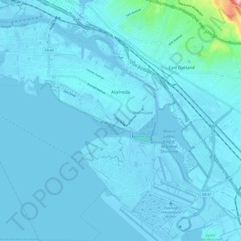
Name: Alameda topographic map, elevation, terrain.

Location: Alameda, Alameda County, California, United States (37.70762 -122.34028 37.80063 -122.22386)

Average elevation: 9 m

Minimum elevation: -7 m

Maximum elevation: 187 m

Other topographic maps

Click on a map to view its topography, its elevation and its terrain.

Cherryland

United States > California > Alameda County

Average elevation: 27 m

Gear up for your next adventure:

🛶Canoe Life Vest - Safety vest for water sports
🛏️Camping Sleeping Mat - Comfortable mats for sleeping outdoors
🧢Outdoor Cap - Protective cap for sun and rain during hikes
🧥Softshell Jacket - Windproof and breathable jacket for hiking
🥾Light Hiking Boots - Lightweight and comfortable boots for day hikes

As an Amazon Associate, this site earns from qualifying purchases at no extra cost to you.